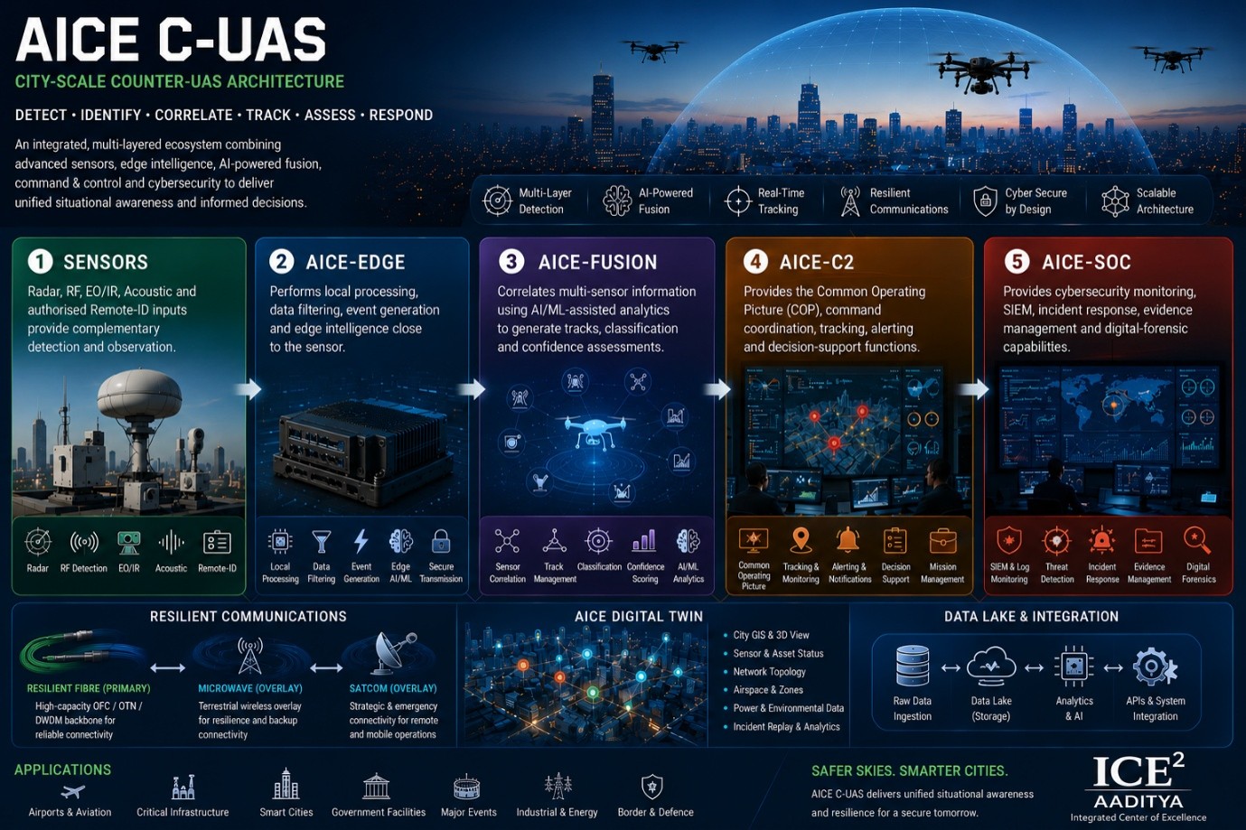
AICE C-UAS — Intelligent Situational Awareness for the Low-Altitude Domain
AICE C-UAS is an integrated, multi-layered Counter-Unmanned Aerial Systems (C-UAS) architecture designed to provide large scale drone situational awareness, detection, identification, tracking, assessment and coordinated response support. The system combines distributed sensors, edge computing, AI-powered sensor fusion, GIS-based situational awareness, resilient communications and cybersecurity into a unified operational ecosystem.
A Complete C-UAS Ecosystem
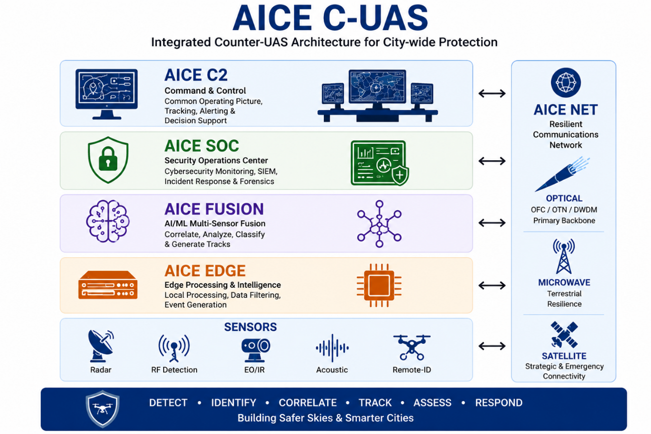
The AICE C-UAS is built around six major layers:
• AICE-C2 Provides the Common Operating Picture (COP), command coordination, tracking, alerting and decision-support functions.
• AICE-SOC Provides cybersecurity monitoring, SIEM, incident response, evidence management and digital-forensic capabilities.
• AICE-FUSION Correlates multi-sensor information using AI/ML-assisted analytics to generate tracks, classification and confidence assessments.
• AICE-EDGE Performs local processing, data filtering, event generation and edge intelligence close to the sensor.
• Sensors Radar, RF, EO/IR, Acoustic and authorised Remote-ID inputs provide complementary detection and observation.
AICE NET Resilient Communication Infrastructure
AICE C-UAS follows a Fibre-First philosophy for city-wide connectivity. High-capacity OFC/OTN/DWDM networks form the primary communications backbone, while microwave provides an independent terrestrial resilience layer and SATCOM provides strategic and emergency connectivity for remote, mobile and critical sites. This multi-path architecture helps maintain operational connectivity even when individual communication links become unavailable.
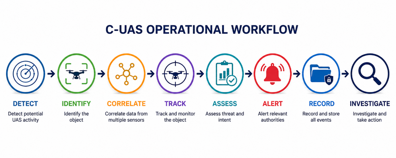
AICE C-UAS Operational Workflow
Key Capabilities
Multi-Layered Detection • AI-Assisted Sensor Fusion • Real-Time Tracking • GIS/COP Visualisation • Edge Intelligence • Resilient Communications • Cybersecurity & SOC • Evidence & Forensics • Digital Twin Integration • Scalable Wide Area Deployment
Designed for Critical Urban Environments
AICE C-UAS can be configured for airports and aviation environments, critical infrastructure, smart cities, major events, government facilities, industrial and energy installations and other sensitive locations. The architecture is modular and scalable—from a single protected site to multiple operational zones and eventually multi-city or national-level federation.
Why AICE C-UAS?
AICE C-UAS brings together Sensors, Communications, AI, GIS, Command-& Control and Cybersecurity into a single engineering framework, enabling security organisations to develop a comprehensive and resilient understanding of the low-altitude environment while maintaining appropriate human command authority.